
|
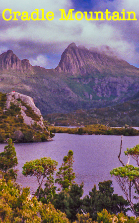
Cradle Mountain, located in the Cradle Mountain-Lake St Clair National Park in central Tasmania is one of my favourite places on Planet Earth. Though only 1545 meters high, the surrounding area with its lakes has a quiet serenity which makes me feel that I could drift back in time more than eight thousand years and observe the same scene. There are several walking tracks of various lengths. Some as short as two hours. The longest walk is the overland trek to Lake St Clair. Today I trekked to the summit of Cradle Mountain and around Dove Lake. |
Following the retreat of the glaciers at the end of the last ice age, about 10,000 years ago, the area was populated by aborigines. Quarries, stone tools, bark huts and extensive button grass plains provide evidence of their habitation. Button grass plains were generated by aborigines using fire to clear the land thereby stimulating new plant growth which attracted animals.
Cradle Mountain was named, because of its resemblance to a miners cradle, in 1827. One could also image it being two horns, the Little Horn and the Big Horn. Henry Hellyer, in 1831, became the first European to climb to the summit.
The orange seen on the mountain slope is due to Nothofugas gunni, a small deciduous beech commonly known as fagus. Endemic to Tasmania, it grows to a maximum height of two meters. The leaves, a centimetre across, turn from dark green in spring through to orange in autumn.
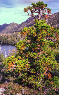
Another species endemic to Tasmania is King Billy Pine (Athrotaxis selaginoides). Not a true pine but evergreen, it can grow to 20 - 30 metres high and can have a trunk girth of up to 1.5 meters.
Gustaf Weindorfer, an Austrian naturalist bought land in the Cradle Valley in 1911. He opened a guest house called the “Waldheim”.
Land from Cradle Mountain to Lake St Clair, about 50kms south, was set aside as a scenic reserve in 1922. Eventually expanded to 125,000ha, the area became a national park in 1971 and upgraded to a World Heritage Area in 1982.
Many people trek overland from Cradle Mountain to Lake St-Clair. The journey takes about five days.
A popular and strenuous day trek is climbing to the Cradle Mountain summit.
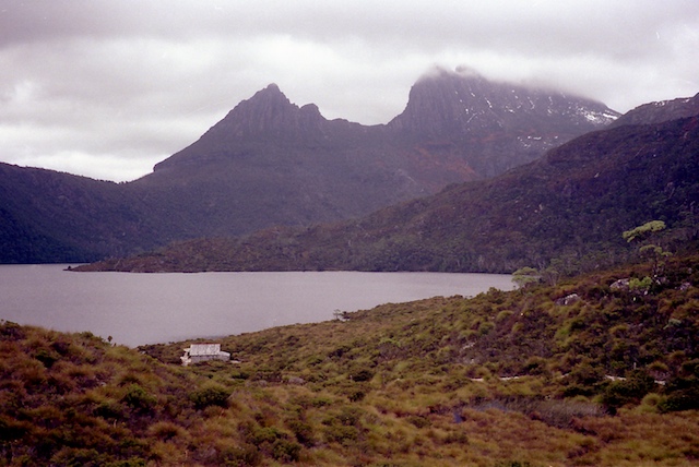
Whether the overland trail or a day trip the first stop is generally a small shingled hut on the edge of Dove Lake called Boat Hut. It and the small adjacent beach it is used as a resting spot for overland and day trekkers. We follow the trend.
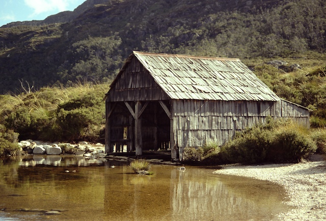
Dove Lake, similar to many lakes in Tasmania, is a glacier lake scoured out in the last ice age.
Water bottles full, boots properly adjusted and laced, we make our way westward (right hand side of photo), pushing ourselves up a scarp, to Marion’s Point at the top. From there it's a walk southward along a fairly level button grass plain to another shingled hut, Kitchen Hut.
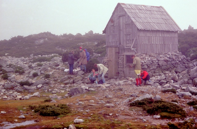
A two story hut, it is used for emergency shelter or to rest before continuing on the overland track or tackling the summit. When we arrive it is cloud covered.
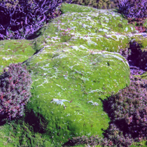
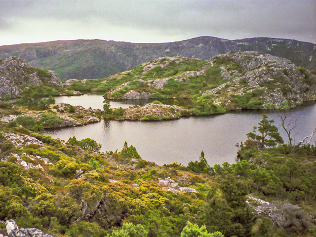
Nearby are many tarn lakes surrounded by cushion plants. Occuring above the tree line these plants look like green cushions laid upon the ground. If you look closely, tiny flowers and leaves can be seen. The dense packing of leaves protects tiny branches from the weather and helps maintain a constant plant core temperature. Delicate, they should not be walked upon.
Cloud lifted, food consumed, it is time to tackle the summit! Though the summit climb is strenuous, sometimes over loose ground, the only physical requirement is mediocre fitness.
Cradle Mountain is formed from Jurassic dolerite and shaped by a 6km ice cap which covered the it during the last ice age. The dolerite forms large crystal like structures which can break apart. Climbing them is similar to climbing over piles of very large bricks.
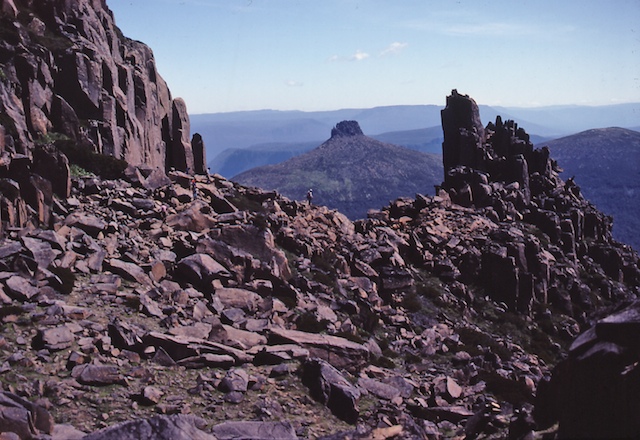
Though only mediocre fitness is required, I still make a number of stops, unlike the park rangers who seem to effortlessly glide to the top. Summit, summit, we all strive to reach the summit. We reach our goal. The atmosphere is clear allowing views to Barn Bluff and beyond. Once again I am consumed with the feeling of being transported centuries past, pre-industrial, maybe even pre-agriculture. Alas, the illusion can not last. We, the unprepared, must be off the mountain by nightfall if we do not wish to experience nature in a less benign mood.
A different route is used for the return. From Kitchen Hut we head not back to Marion’s Point but across the mountain face. We stop below the Little Horn for a magnificent view of Dove Lake.
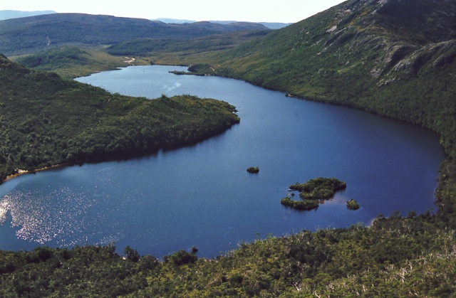
Following the path across the top of the ridge on the eastern side (right hand side in photo) of Dove Lake we trek, past Lake Hanson, located on the opposite side the ridge, from Dove Lake. We continue on to a rock known as Suicide Rock located near the car park.
Once there, most make their way to the car park and Pencil Pine Lodge.
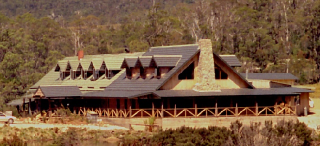
Pencil Pine Lodge located outside of the World Heritage Area is where trekkers can go for food and accomodation. Perhaps pepperberry seasoned venison loin is to your liking or maybe a poached fillet of Macquarie Harbour ocean trout will satisfy your hard earned appetite. Each evening appropriate scraps are fed to native animals giving visitors an opportunity to see, amongst others, possums, quolls and the infamous Tasmanian Devil. Dinner over, guests retire to the lounge to reminisce the days activities around a cozy wood fire.
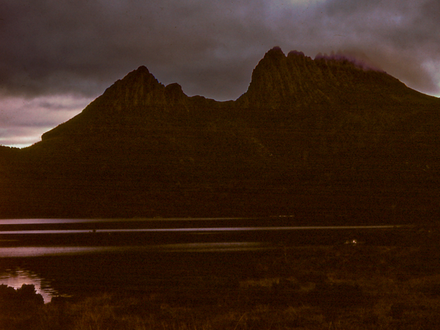
Yes, I did say most, but not all, for a few something still remains, the coming of night. When there is no rain and the still air is pleasantly cold, the long twilight works its magic. Last red abandons the western mountain side. Details are gently surrendered, the mountain forming a silhouette against the still light sky. Mountain, sky, lake, gently merge into the inky blackness of night.
