

|
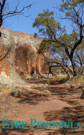
The triangle shaped Eyre Peninsula located between Spencer's Gulf and the Great Australian Bight in South Australia was named after Edward John Eyre (1815-1901). Edward John Eyre, with his aboriginal friend Wylie, were the first to cross Australia from east to west. It has area of approximately 170,000sq kms with a population of 55,000. I had to get up 5:00am and drive 160 kms from Adelaide to Walleroo to catch the 8:00am ferry. The ferry took me across Spencer's Gulf to Lucky Bay on the Eyre. |
Leaving Lucky Bay, ignoring Cowell, I drove inland, down a road I have never been, a road that I have driven hundreds of kilometers along, a road where mallee and the three strand barb-wire fence separate road from paddock.
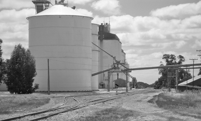
Lock, in the middle of the Eyre appeared. Its wheat silo, rail head, cafe and an old painted tractor posing as a pioneer museum, were, a blink later, in the rear vision mirror.
Road and farms continue, some fields have a crop of rocks instead of wheat or barley. Sometimes pine replaces the mallee. The road terminates in the coastal town of Elliston.
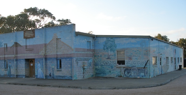
Lying on Waterloo Bay, a coastal inlet partially protected by a rock reef, Elliston has a population of 380. Its economy revolves around farming, sheep grazing, fishing and tourism. Tourism in turn is based on recreational fishing and water activity in Waterloo Bay. A claim to fame is a 500 square meter mural depicting the area's history painted on the town hall.
On the second day once again I rose early. I hoped to reached Streaky Bay by late afternoon. Streaky Bay is only 126km from Elliston. However it is the journey, not the destination, that is of prime importance. In keeping with this philosophy, I stopped at Venus Bay.
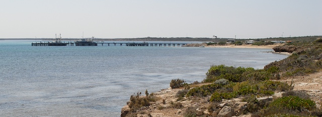
It is a locale in which I could spend a week or two walking along beach and jetty, fishing, taking photographs and writing of travel experiences in exotic locations far from Venus Bay. An hour later, or was it two, I continued to Murphy's Haystacks.
Murphy's Haystacks are not haystacks but geological formations called inselbergs. Formed by the weathering of crystalline rock, the fractured sections wear faster than un-fractured sections. Though the haystacks are only 100,000 years old, the pink rock which they are composed, hiltabe granite, is 1.5 billion years old.
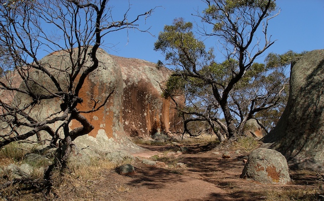
Amongst these inselbergs I had visions aboriginal corroborees thousands of years before the arrival of Europeans. Turning only slightly, visions of pre-European corroborees were brutally destroyed by a shed, a paddock, a cylindrical concentrate toilet and in the distance, a wheat silo. I spent about an hour or so at Murphy's Haystacks with my companions, the bush flies who think my eyes are lakes for drinking.
On the road to Streaky Bay were many sleepy lizards ambling across oblivious to mortal danger.
Streaky Bay, on arrival around 4pm, appears deserted. Similar to most small towns on the Eyre it has its murals. Further decoration is provided by totem poles and mosaic covered public seats.
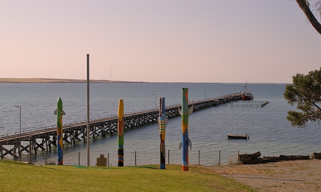
After completing the obligatory and pleasant walk along the foreshore and jetty I retired to the hotel for the evening meal, a nice peppered T-bone steak.
There are a number of inselbergs on the Eyre Peninsula. Another is Pildappa rock, also known as wave rock, near the town of Minnipa. It is called this because from some angles, it does look like a wave. Its shape has been sculptured by subterranean weathering proceeding faster than surface weathering. Surface evaporation decreases the erosion rate.
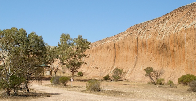
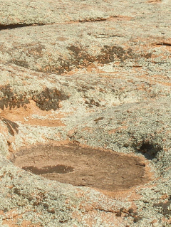
Over aeons the ground eroded away exposing the concave surface. Its surface is covered with small pool basins called gnammas and water worn grooves called rillens. Looking at the rillens and gnammas brought the realization that this would have been much more spectacular after a heavy rain storm.
|
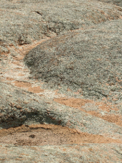 |
Gnammas |
Rillen |
Leaving Pildappa Rock I drove south along the highway, through the middle of the Eyre to Port Lincoln. "Lock, did I pass through Lock? I must have blinked!"
Port Lincoln is located on Boston Bay in the south of the Eyre Peninsula. Partly because of its deep natural harbour it was once considered as a site for South Australia's capital.
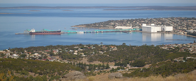
Rejection, because of inadequate fresh water supply, didn't stop it from growing to a city of 14,000 people boasting more millionaires/capita than any other town or city in Australia. The source of this wealth is the Southern Blue Fin Tuna, a one meter long smokey black fish capable of swimming up to 70kms/hr. Japanese are willing to pay thousands of dollars for sushimi-grade tuna. Tuna are fished using long lines. In recent years, in response to declining tuna stocks, aqua culture farming has come more prominent.
At the southern tip of the Eyre is Whalers Way, a 14km scenic drive along a rugged coastline of crevasses, blow holes and some very tempting rock pools. Because it is on private land a fee and a key was required. Food and water must be taken.
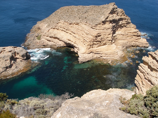
Swimming in some of the rocks pools is not recommended. Here on the edge of the world, with no land farther south until Antartica, unexpected sea swells can come and totally scour out everything in the rock pools, including unwary swimmers.
A few emus were seen, but as expected, no kangaroos, as they generally do not come out until dusk.
As my journey came to its conclusion I drove north, along the Lincoln Highway, to catch the ferry at Lucky Bay. Along the highway are a number of small towns, almost villages, such as Arno Bay, Port Neil, Tumby Bay. Because of the mild climate and long stretches of sandy beaches they are popular for swimming, boating, fishing and generally chilling out. And I do, chill out, taking several stops before reaching the last town before Lucky Bay, Cowell.
Cowell is noted for its jade deposits, among the oldest and largest in the world. It is a deposit of high quality nephite jade (traditional Chinese jade) which can vary in colour from white, yellow, green, brown to black depending on the amount of iron present. Cowell jades vary from the common green to the rare black. An important property of jade, in addition to its colour, is its toughness allowing it to be delicately carved.
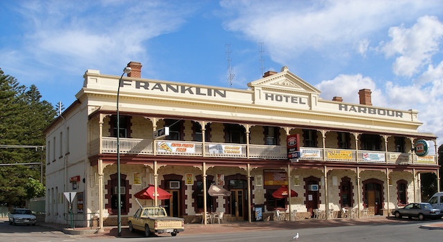
Of more interest to me than jade is the local pub where I indulge in a languorous lunch before commencing the journey's final leg, the journey back to Adelaide.